Posts

Showing posts from June, 2022

Thursday, June 30, Fargo ND to Callaway, MN

One note about yesterday: we passed 2000 miles total for our trip yesterday after about 2/3 of our ride! We stayed in a motel last night as it was quite windy and there was a strong chance of thunderstorms during the night. We both think we might have heard some thunder during the night and there were puddles outside this morning. We wound our way north and east and rejoined the route. Soon we crossed the Red River into Moorhead and headed north  paralleling the river for a while. Passed a huge sugar plant. After turning east we continued through the flat landscape of the valley through large agricultural fields with rich-looking soil for miles. Jim said, “For the first time on this trip, I’m getting bored.”     It seemed flat and monotonous and sterile—with little sign of life except for an occasional red-winged blackbird in the ditch and the vehicles on the road. After 12-14 miles or so, we had a short, easy climb out of the valley and the landscape became interesting again.     Late
Wednesday, June 29, Little Yellowstone Park to Fargo

Image
  Last night a couple pulled into the park with just a plain pickup truck with a cap. We started chatting with them and found out they were from Central Texas and had spent time working on computers and other things in China for 6 years and  also spent some time in Thailand. They are also avid bird watchers.  They had been in Wisconsin for something and were now wandering around seeing the countryside and bird watching. For sleeping, they just had a mattress in the back of their pickup truck, a pretty simple setup.    We were worried about headwinds today so got an early start and left about  6:45 .  We crossed the Sheyenne River and climbed up out of the valley shortly after leaving the park. We noticed that there were almost no lakes and ponds along this section of the road. We went about 17 miles or so then ate a big breakfast at the TraXside Cafe in  Enderlin North Dakota. (Generous portions of pancakes, ham and eggs)  The town had a sign as you entered that they were “bicycle frie

June 28, Tuesday, Gackle to Little Yellowstone State Park,ND

The bike hostel we stayed in is called the "Honey Hub."  When we turned on the side streets of the little town of Gackle (we asked and found out that there had been a Mr Gackle) we started seeing signs saying cyclist housing with an arrow and followed them alongside a house and across a back yard and we felt uncertain but people up on the deck assured us we were at the right place. On the back of the house on the other side of the deck was a door into a room with several beds, a bathroom and washer/dryer. Why the name? The owner is a 5th generation beekeeper that grew up in the town and they stay there during the summer.  They place bees all over the area during the summer months to pollinate the crops then truck them to California for the other nine months of the year to overwinter in a milder climate and pollinate there. It takes 30 semi loads to mhouse ove them.  We were the only ones staying there, but at times in past years they have had multudes of tents behind the hous

Monday, June 27, Hazelton to Gackle

Image
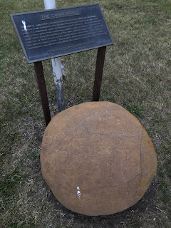
The Hazleton Community Park was a  quiet restful place to sleep—it also probably didn't hurt the weather was very nice.  Large round natural concretion at the park in Hazelton  Today we had mild winds at our backs, sunny skies with a few white clouds, pleasant temperatures and low humidity on low traffic roads—what more could we ask for! After riding about 15 mi or so we saw a small grove of trees fairly close to the road so we decided to take a break there as we could sit in the shade. We ended up spending about 40 minutes there because in amongst this little grove of trees were a number of birds. Kay first saw an orchard oriole, then id’ed about 10 species by sound recording of their songs and 4 or 5    by seeing them. Also, as Jim went back to the bikes, a buck ran across the road just ahead of him and into the trees. Just west of Napoleon there is a large lake, maybe a mile diameter, and saw some people fishing there. They were catching Walleyes and Northern Pike from the shore

Sunday, June 26, Mandan to Hazelton

Image
Began the day with a little bit of comedy: we went to get breakfast at the motel but the door was locked.  We had specifically checked the time the night before so thought we would give them a few minutes and return to our room--and we were trapped outside as we left our key in the room.  So we rang the doorbell and finally got someone to get our door unlocked and let us get our simple motel breakfast.  We had about a 5-mile ride to First Lutheran Church of Bismarck which originally was Swedish Evangelical Lutheran Church. The Sermon was on the woman who washed Jesus feet with her tears and hair.   Point is not to become too self-righteous and realize  we're all sinners. After church there was a celebration of the 50th wedding anniversary of their pastor and his wife, and so got some cake and cookies and juice. We had a fun visit with a couple named John and Bonnie, they're approximately 75 and been married about 54 years.  They were farmers and  about a decade ago,  retired an

Saturday, June 25, Richardton to Mandan, ND

Image
https://ridewithgps.com/trips/94589440 Slept in a little bit this morning and had the leftover sandwich from the Sit-N-Bull bar for breakfast. Today was also predicted to be quite windy, 20 to 28 mph, but was now a tailwind. It was only about 53 when we left and stay cool so we wore our tights for the first time in a while. We were thinking of stopping in Hebron to get something to eat and as we rounded a curve, we saw some bleachers with a whole bunch of pickups nearby (and also some porta-potties) so we stopped. There was going to be a mud run that afternoon for different classes of trucks from stock to souped-up to open class.  They would be timed running through about a 150 yd long mud pit. We learned that this mud run had been going on for about 10 years and it can take as little as 3 seconds to win the money for a souped-up model in the open class. They also had a food truck there so we were all set. The only thing hot to drink that they had was coffee so we had that and a couple

Friday, June 24, Medora to Richardton

Image
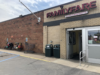
  We left Medora a little bit before eight with some clouds and a mild wind from the side. While we were still in town, on the main drag, right by what is probably the biggest motel in town, a buck with velvet on his antlers came trotting up the side road to the corner.  Our route led us along the edge of Theodore Roosevelt national park, which has a badlands-type landscape. We also stopped at the Painted Canyon visitor center as it was also the rest stop,    and looked out over the landscape of the canyon. At one point along the road, we saw evidence that a pipeline had been installed. Since we had started to see oil wells and tanks, we figured it was an oil pipeline. When we came upon where they were installing it, we chatted with the supervisor, and found out it was a water pipeline. We made it to Dickinson which is the end of section three of our route maps. We got food for lunch from Family Fare which we smiled to see as that is the local grocery store that we shop at in our town.

Makoshika State Park(Glendive) to Medora, ND

Image
https://ridewithgps.com/trips/94387644 Last night because the campsite was so isolated and the sky was so clear, we slept out under the stars. It was amazing to watch the stars, and unless you stood up and looked down into the valley, you wouldn't see any man-made lights. When Kay walked over to watch the sunset, she came with bad news. While near the bikes, she started hearing a loud hissing sound that seemed to come from the front of Jim's bike. Jim's front tire had deflated again, that's like the fourth time on this trip. So the first order of business for Jim this morning was fixing the tire. The ride out of the park was very pleasant as mostly downhill including the 3/8 mile,15% grade switchbacks, which we took slowly and cautiously.  After leaving Glendive, the land for the first 15 to 20 miles was very productive-looking with very green and lush fields until we got fairly close to Medora, then had more hills and outcroppings with poorer ground. Had a great lunch

June 22 Wednesday pictures

Image
God made bridge in Park Sunset from where we were to sleep

June 22, Wednesday, Glendive to Makoshika, State Park MT

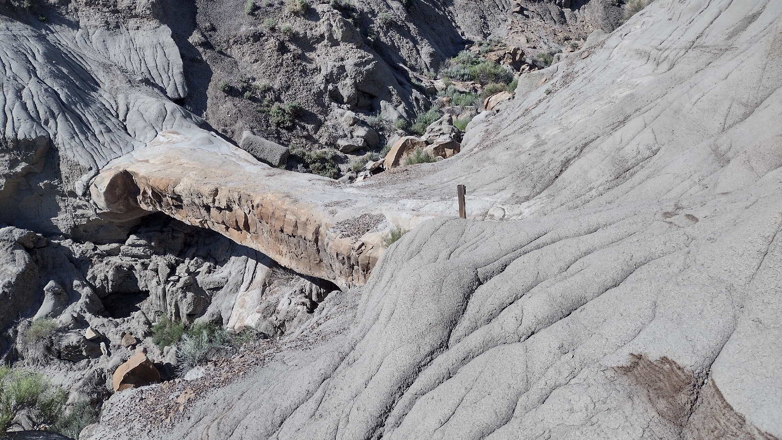
One additional note about the town Terry from yesterday: the Kempton Hotel in town is the oldest continuously operating hotel in Montana. And when we crossed the Yellowstone, we measured on the bike odometer from the middle of the bridge to the end, 0.11 miles, so the river was about two-tenths of a mile across.     Our warm showers host was a former librarian and newspaper story writer who was also overseas for several years in Uganda and Mozambique. We were pretty tired last night and slept in this morning.   Decided to go see the nearby state park which contains badlands. The area used to be an old sea some 50 to 70 million years ago, then after that dinosaurs were in the area, with fossils being found here in a certain exposed layer. There are multiple strata of many different colors--very beautiful to look at. Over half of today's movement was hiking so did  7 miles on a bike and 7 miles hiking through the the park.  Tonight we are camping in the park at about 2500 ft in a ver

June 21 Tuesday Miles City to Glendive, MT

Image
https://ridewithgps.com/trips/94180454 Today after a breakfast with food that we got at Walmart last night, we got an early start as had a bit longer distance to Glendive. It was cool and cloudy so, although we started off wearing shorts, we had a lot more clothes on top plus gloves. Today was another day of following the Yellowstone River Valley. We headed out on the old road leading out of Miles City which was very smooth and straight and low traffic and even had a mild tailwind. The first sunlight we saw was lighting up some of the hills on the other side of the valley, while we were under a cloud cover. Farms along the road did a lot of irrigation. Saw a number of historical plaques talking about trains, past military campaigns, and management of the range for effective use of it. Stopped in a small town called Terry, named after General Terry. While Jim stopped at the post office, Kay went past it to check out the church building beyond and it was a Presbyterian Church.  She m

Monday June 20, Forsyth to Miles City Montana

Image
https://ridewithgps.com/trips/94080680   After breakfast, we walked over to the Animal House Veterinary Hospital, which was very close to our hotel, to see Dr. Rick Smith, who was then one of the vets at the Miles City practice where Jim did his externship. We got to chat with him between him helping a few clients then had lunch with him before leaving. From him and from a man packing up to go home, we heard about the Quigley Shoot which happened this past weekend in Forsyth. 500     people came to it from five different countries. They use black powder and make their own bullets and shoot at targets 350 to 850 yards away. Yesterday as we came into town, we crossed the Yellowstone River; we noticed it was high as we hurriedly crossed in the rain. There’s been some minor flooding but nothing like what happened farther upstream.     Today we followed the valley downstream and had occasional views of the river from far away. We took the old road about  half the way there and t

Sunday June 19, Roundup to Forsyth, MT

Image
https://ridewithgps.com/trips/93968933 Wide open spaces    Last night we had looked up times of worship services at churches in Roundup. But all seemed to be later in the morning and we wanted to get an early start as rain and thunderstorms were predicted later in the day. Then fo und out that  the Community Bible Church in Musselshell, a small town 24 miles along our route, had a service at 9 am. So we got up about 5:00 a.m. and left a little bit after 6:00 a.m., skipping the motel breakfast so we could get there on time. We saw whitetail and mule deer and even a sleeping bald eagle on a power pole who didn’t wake up until we were almost past. We also saw some medium brown vertical rock faces that had streaks of a dark color running down them. We called them the chocolate syrup cliffs. We had a little bit of light rain on the way there and arrived well on time. The sermon was on Hebrews 7, how Jesus is an advocate for us and the people were very welcoming. Afte

Saturday, June 18, Lewistown to Roundup, MT

Image
  To Roundup   https://ridewithgps.com/trips/93850661 We got up a little before the sun, as did the other 2 bicyclists, to get going as soon as possible as today was supposed to be hot. Pilots also were up early as there were a number of small planes flying around the airport behind us as we got ready to leave. A sign said that a lot of airmen had trained here during WW2. The morning was cool and sunny, and we had a beautiful ride as we left Lewistown. We gradually climbed up a valley for 10 miles, green with trees and pastures and we saw 3 elk about 1/2 to 3/4 a mile away up on a ridge. We also saw a number of deer and antelope today. Traffic was light, mainly pickups pulling horse trailers.  When we got to Grass Range, we had a decision point. Chris, the bicyclist heading west, had told us last night that a large section of the route about 3 days out for us was under construction with the old pavement torn out so it was a    difficult gravel stretch. Someone working there

Friday, Jun 17, Stanford to Lewistown, MT

Image
  We wanted to get an early start as winds were supposed to be stronger as the day went on and the temperature was supposed to climb to 90.     So today was the first time we put on our shorts and we set off a little after 7 on a bright, clear morning with little wind and a waning moon low in the west. We could still see a few mountains with some snow on their tops and thought this might be the last time but continued to see new ones during the day. At one stretch of the road two large birds with very, very long beaks started circling us and crying out. We figured out that they were long-billed curlews. We think they were acting like killdeer in seeking to draw us away from where they were nesting. We think we saw one of them south of Cut Bank as well but that one was walking on the ground. We also saw a good-sized dead bird along the roadside, it was an owl. As the road curved around the village of Moccasin, saw a lady cleaning up a little entry garden into the small villa

June 16, Great Falls to Stanford

Image
https://ridewithgps.com/trips/93604103   A bright crisp morning with the promise of warmth to come. Starting off, the wind was 2 mph! and the temperature about 45. We rode through a number of city blocks before rejoining the route on state highway 200 (also known as 2 US highways and another state highway—4 numbers in all). Thankfully it had a very good shoulder and we took that out of town, by an Air Force Base and up and down over the rolling hills through the countryside. One mountain we saw was part of the “Little Belt” mountains and it was quite apropos as it had a level outcropping running around its middle just like a belt. The bicycle route eventually took us off the highway into a small town also called Belt. This at one time had been a center of coal mining and one mine in the area once produced 2500 tons of coal a day. It was used for smelters in Great Falls and for the Great Northern Railroad.  Taxidermy in the grocery store in Belt As we wound along a little valley towards

Wednesday June 15, Dutton to Great Falls, MT

Image
As we woke up, the wind was still howling, but no rain. We seem to be able to take one or the other but not both, at least not in cool weather. We were a little startled early on by a woman coming in to change the altar and pulpit cloths so they would be the correct liturgical color for Sunday. Hopefully we didn’t startle her too much. Once underway, we again rode with the wind mainly mainly perpendicular to our route. Most of our route today was on the same road as before paralleling the interstate, so very low traffic until we were near Great Falls. In fact, we went about 8 miles with only seeing 2 vehicles, one in each direction. About 8 miles from Great Falls, the road bent more east so the wind was more on our tail and pushed us along to Great Falls. After crossing the Missouri River on the west side of town, we followed     it along a bike path and on to Giant Springs State Park, seeing 3 of the 5 falls in the area.  Black Eagle Falls and dam Rainbow Falls and dam We then saw the

June 14 Conrad to Dutton, Montana

Image
our refuge in the storm  Our waitress who hike across America   https://ridewithgps.com/trips/93359973 We were again glad to be inside last night as it was rainy and cold. Sounded like we had a good chance of rain today plus wind (“It’s always windy here”) and, unlike much of the country, only up to about 50.  But it wasn’t raining, so off we went. The wind was again mainly coming from our side and we were on a road with little traffic as it parallels the interstate quite closely. After a snack stop in Brady, the rain started, making for a cold, wet, miserable ride. Kay thought “I don’t like riding in this rain, but I know they really need it here.” We had been hearing how they were in a bad drought around here that was severely affecting the crops. We soldiered on until we got to Dutton, where we stopped at the Dutton Drive-In, a diner with a bunch of pickup trucks outside, and parked our bikes on the lee side of the building and headed in to get some hot food,

June 13 Cut Bank to Conrad, more about it.

Image
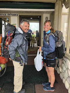
At the hotel breakfast we chatted with a couple who were taking a motorcycle to Glacier and warned them about the snow advisory starting in the evening  in the Glacier area. They were just like us with being a little bit puzzled with a not-so-great forecast: do you wait or you just keep going?     We are thankful to be well out of that area before the snow hits.   We did have rain during the night and it was quite wet as wheeled our bikes outside. The hiking couple came out just then so we took a picture of them and they took a picture of us and we got their Facebook page to keep track of what they're doing.   We are thankful that the only wetness we had was possibly a tiny bit of drizzle and for sure some road spray for the first mile or two. We could see the clouds and rain off to the east and behind us and at times over the mountains but we had partly sunny skies. And WIND!    That was the defining thing about the day.    It was out of the west and we were heading south so gusts

June 13, Monday, Cut Bank to Conrad, Mt

Image
https://ridewithgps.com/trips/93280013 Getting to bed late, so just location and a picture taking a look back to the mountains over fallow(brown) and non fallow field, 2nd picture from grocery in Valier, MT they make great sandwiches there and owner's great grandfather started store in 1903 as town's first pharmacist.

June 12 pictures

Image
Upper photo couple motorcycling across USA and back through Canada. Lower bout 30 miles out on  prairie looking back at Glacier National Park

June 12, Sunday, Essex to Cut Bank

https://ridewithgps.com/trips/93049886 We got up a little bit after 6:00 and left at approximately 730 after a breakfast of bagels and peanut butter. It was misting just a little bit as we got ready to leave and for the first few miles. Today we finally entered Glacier National Park--the highway crossed the Middle Fork of the Flathead River and we were officially in (for a few miles).  It soon became partly cloudy and we got some nice sunshine and clear views of the mountains. We stopped at a waterfall, called the Silver Staircase Falls (we also heard someone call it Stairway to Heaven) outside the park. The water comes down over ledges on the hillside that look like steps, very beautiful. At this spot we met a couple from Eastern Ontario who are traveling on motorcycles to Vancouver BC and then back home through Canada, going almost 7,000 miles or more. We felt bonded to one another as we both wore very bright rain suits.  We were wearing ours both for rain and because it was fairly c

June 11 photos

Image
  Marion Creek descending the mountain  Marion Lake Getting close to the lake  Early in the hike 

June 11, Saturday Isaak Walton Inn to Marion Lake and back

https://ridewithgps.com/trips/93049886 Today we had three fancy meals at the Inn with very good food.   Our Whitefish Warm Showers host  recommended the hike to Marion Lake so this 8-mile round trip hike  with about 2000 feet of climb was our activity for the day.  The last 20% had increasing amounts of snow sometimes as  thick as 4 feet. The lake was three quarters covered by ice and snow. As we walked up the mountain we saw many plants that were emerging from being snow covered just very recently, white and purple trillium, spring beauties and many other plants we could not identify. We found it a bit challenging but very pleasant hike. It drizzled or rained a good share of the time so we got quite wet and a bit chilled at the higher elevations. And then at other times the sun would come out and  warm us up.  We were amazed at all the beautiful mushrooms of different varieties as well as the tallest morel Kay had  ever seen which she was very tempted to pick but she had nowhere to co

Photos from June 10

Image
Where the North Fork and the Middle fork of the Flathead River come together.  Track maintenance equipment that pulled up and parked while we were at the West Glacier station.  Along the southern border of Glacier National Park  Izaak Walton Inn

June 10 Friday, Whitefish to Essex, MT

https://ridewithgps.com/trips/92918327   (June 10 route) We did not get around to posting anything written about our journey yesterday because it was just very late by the time the day got done. (We had too much fun with our Warm Showers hosts). We finally had a day with no rain. In Eureka we were only about 6 miles from the Canadian border.  Leaving town, we had a wonderful road at first with little traffic and several deer sightings.  Had mid morning snack in Fortine with good tasting muffins.   We saw Becky who we'd had supper with her and her husband two days before and spent some time chatting about some of the maladies of being in our 60s. Here we rejoined the main road, US 93. We had great views of the mountains with snow on them and occasionally of the river that we followed a lot of the way. The road for the most part was pretty reasonable as far as traffic but the last 6 miles or so before we got into Whitefish was very busy with poor shoulders and so was a very unpleasan

June 9 Thursday Eureka to Whitefish, MT

Image
https://ridewithgps.com/trips/92808058 Flowers along the road today  juvenile eagle we saw at the dam yesterday  the Libby dam

Wednesday June 9, Libby to Eureka, MT

 https://ridewithgps.com/trips/92676790 Jim woke up about 5:30 Montana time so just in time for the pinkness of a beautiful sunrise.  We had peanut butter sandwiches and fruit for breakfast. It was about 50 and cloudy and felt cool as we left.  We had a new experience for us.  From the edge of town we went almost 13 miles on one road all the way to its end without seeing any vehicles except for the sag vehicle for another bicyclist as we approached its end. We turned off to see the Libby dam. One large problem: it has a long access road which went down a big hill. So we ended up with extra miles and an extra mile-long hill climb added to our day. The dam was huge, 422 feet tall, and backs up a 90 mile lake that reaches into Canada.  So Lake Koocanusa was the influence on us during today's ride.  We saw a bunch of ducks swimming below the dam which we think were common mergansers, and a number of both adult and juvenile bald eagles.  We were lucky to get within about 20 ft of one of

June 7 Tuesday, Clark's Fork, ID to Libby, MT

Image
https://ridewithgps.com/trips/92593980 Beautiful vistas  Scene of logging truck accident  Kootenai Falls We were awakened this morning by two dogs clattering up the stairs and jumping on the bed. The smaller one wiggled his way between us and lay on his side with his paw on Jim  We had a great breakfast made by our warm showers host and had fun talking about dogs and life in northern Idaho. It was a beautiful day and we saw an cow elk a few miles into the ride. She was 3/8 of a mile away across a field and looked like a strange stump until she moved.  More beautiful vistas and snowcapped mountains, and reflections in the water as we traveled along a reservoir on the Clark Fork River. We came upon a bad accident of a logging truck and a pickup with the vehicles all twisted up and off the side of the road and logs strewn over the highway like toothpicks.  We heard that no one was killed but people had to be extricated from vehicles, which had all happe